Instrument Platforms
Brief summary of the field experience instrument platforms available during the ASI-FSCA:
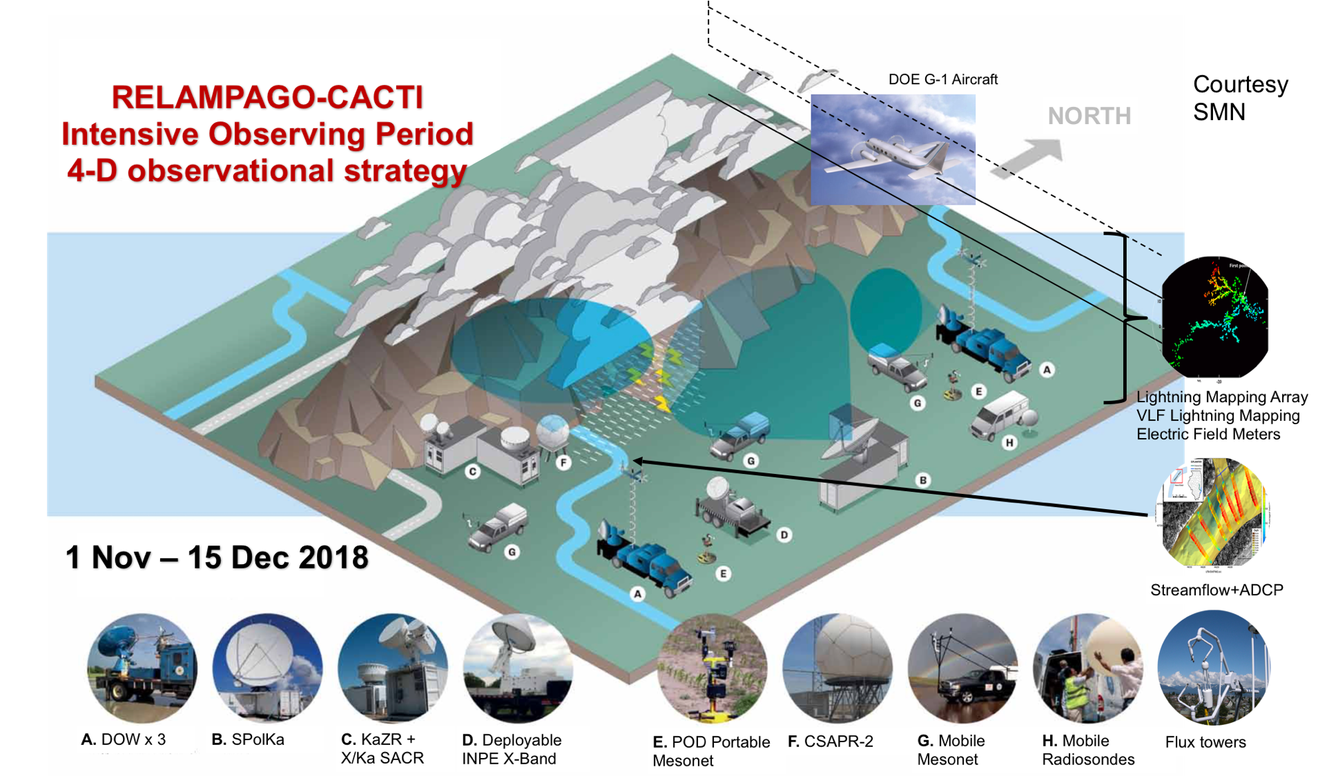
 S-PolKa research radar (Lead scientists: Angela Rowe, Kristen Rasmussen, Steve Nesbitt): The SPolKa radar is a research-quality polarimetric S- and Ka- band radar operated by NCAR/EOL and will be deployed for 24-7 operations on the plains south of Córdoba. It has the ability to capture the pre-initiation, initiation, upscale growth, and severe weather production stages of convection, providing high quality moisture and precipitation retrievals at ranges < 100 km.
 Doppler on Wheels (DOW) mobile radars (Lead scientists: Josh Wurman, Karen Kosiba): The DOW radars are mobile, X-band radars developed and operated by the Center for Severe Weather Research (CSWR). The network of 3 DOWs will focus on observing convective to mesoscale kinematic and microphysical fields, airmass boundaries, and gravity waves.
 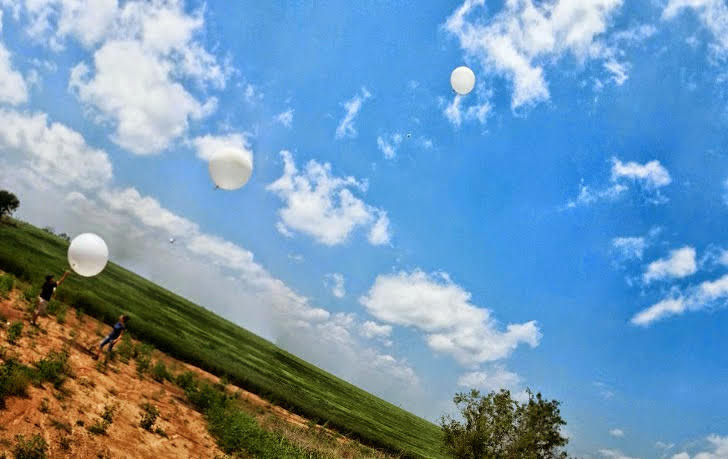 Mobile atmospheric soundings (Lead scientists: Jeff Trapp, Steve Nesbitt, Russ Schumacher): Radiosonde observations (soundings) will be collected using mobile systems to help characterize the evolution of wind, temperature, and humidity vertical structure, helping to reveal mechanisms of convective initiation, organization, and upscale growth.
- Lightning Equipment (Lead scientists: Larry Carey, Wiebke Deierling): Arrays of LF lightning sensors, ground based electric field meters, electric fields mills, and a 10 station NASA Lightning Mapping Array (LMA; Rison et al. 1999) will be deployed near Córdoba during RELAMPAGO. This instrumentation will be used to measure lightning characteristics and electric fields of clouds, and combined with other RELAMPAGO observations allow the investigation of mechanisms that lead to extremely high per-storm lightning flash rates.
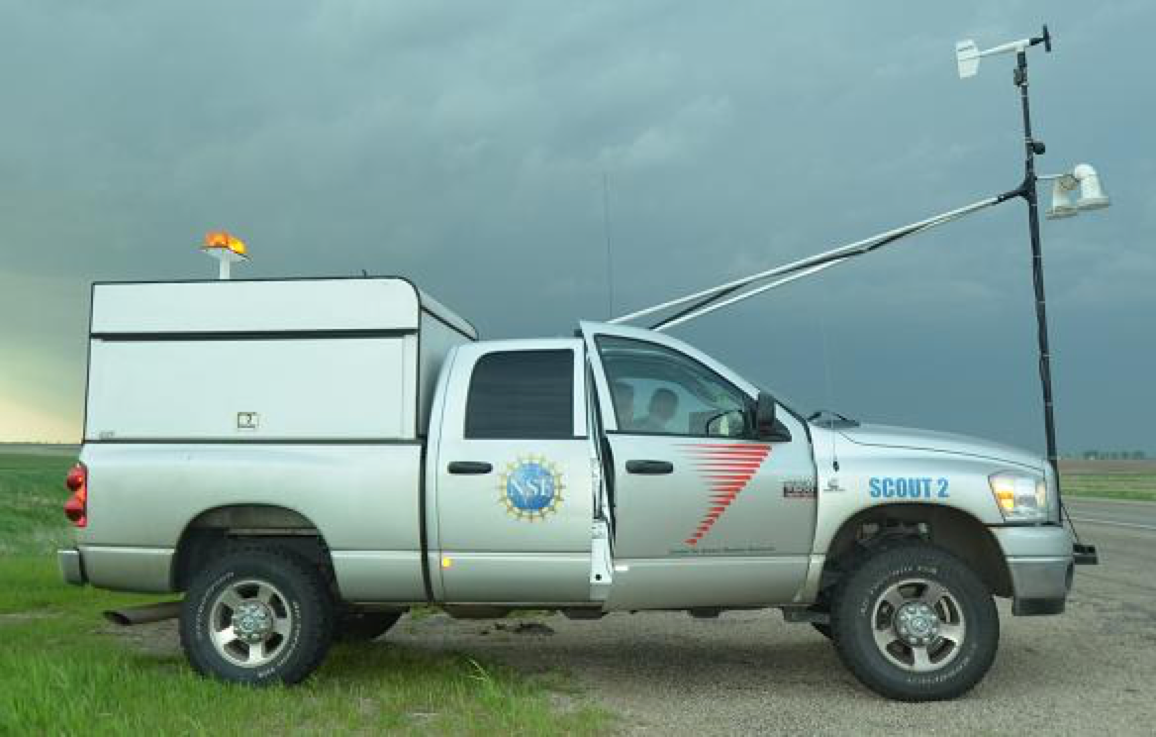
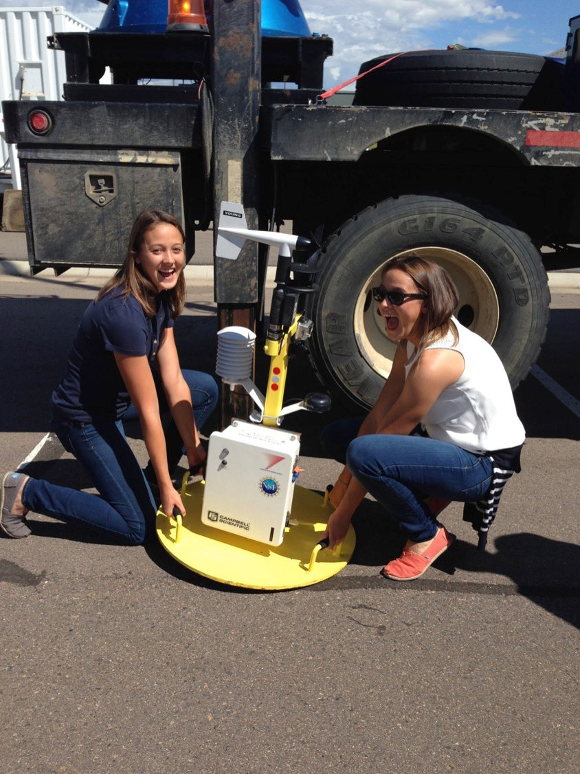 Mesonets and Portable Weather Stations (Lead scientist: Karen Kosiba): An array of unmanned surface weather stations (Pods; Wurman et al. 2012) will be deployed by mobile crews. The CSWR Pods obtain 1-m observations of temperature, relative humidity, pressure, wind speed and direction, and GPS location to capture the surface spatial and temporal variability of meteorological state variables that characterize features, such as convergence boundaries and cold pool strength.